
Trace a Concord Township Street by Address
A Concord Township street search works best when the same parcel is carried from one official record to the next. The Lake County Auditor provides the address, parcel identifier, and assessed owner. LakeNavigator then shows the parcel in relation to its roads and adjoining lots. The Recorder’s instruments establish recorded transfer evidence, while Morley Library’s address-first volumes can add a dated directory listing. The state voter tool is person-first, not a street browser, so it cannot turn a road search into a roster.
- Search the Lake County Auditor Basic Property Search with the house number and street text. Save the displayed parcel ID, situs address, legal description, and assessed owner exactly as shown.
- Open the parcel in LakeNavigator by address, owner, or PIN. Check that the selected polygon and road match the intended Concord Township location.
- Use the legal description and the current owner’s acquisition record to locate the relevant instrument in the Recorder’s AVA index or Records Room. A matching surname alone does not prove the parcel is the same.
- For a historic address, consult Morley’s Haines criss-cross volume for the available year, then use the alphabetic listing and its own abbreviation key to read the entry.
- Keep each result labeled by source and date. A parcel record, a map, a deed, and a directory entry are evidence of different things.
Note: A county parcel search identifies land records and assessed ownership, not every person who may be associated with an address.
Concord Township Street Directory Fields
The Auditor’s free property form is the practical entry point for a whole Concord Township road. Its instructions say to leave off the street suffix for a better address search, and an asterisk can broaden the result. Use a short street entry first, then inspect results one parcel at a time. Direction, suffix, postal code, sorting, and page-size controls prevent a long street result from becoming an uncheckable list.
| Auditor field | Format | Street-directory use |
|---|---|---|
| Parcel ID | Text, up to 20 characters | Use the exact identifier to connect the parcel to map and deed work. |
| Owner | Full or partial text, wildcard accepted | Refines a known assessed-owner record without treating it as an occupant finding. |
| Address number and direction | Text plus A, E, N, R, S, or W selector | Separates similar street forms before opening a parcel card. |
| Street and suffix | Street text plus suffix list | Leave suffix off initially; partial text or a wildcard can return a street set. |
| Postal Code and sort | Five-character text; address, owner, or parcel sort | Use only with a narrower address clue, then sort by parcel address for review. |
The Advanced and Sales Search adds criteria controls and a date picker. Its current-data date changes, so record the date you searched instead of treating a current screen as an older street snapshot.
See the Lake County advanced property search before using a broad street query.
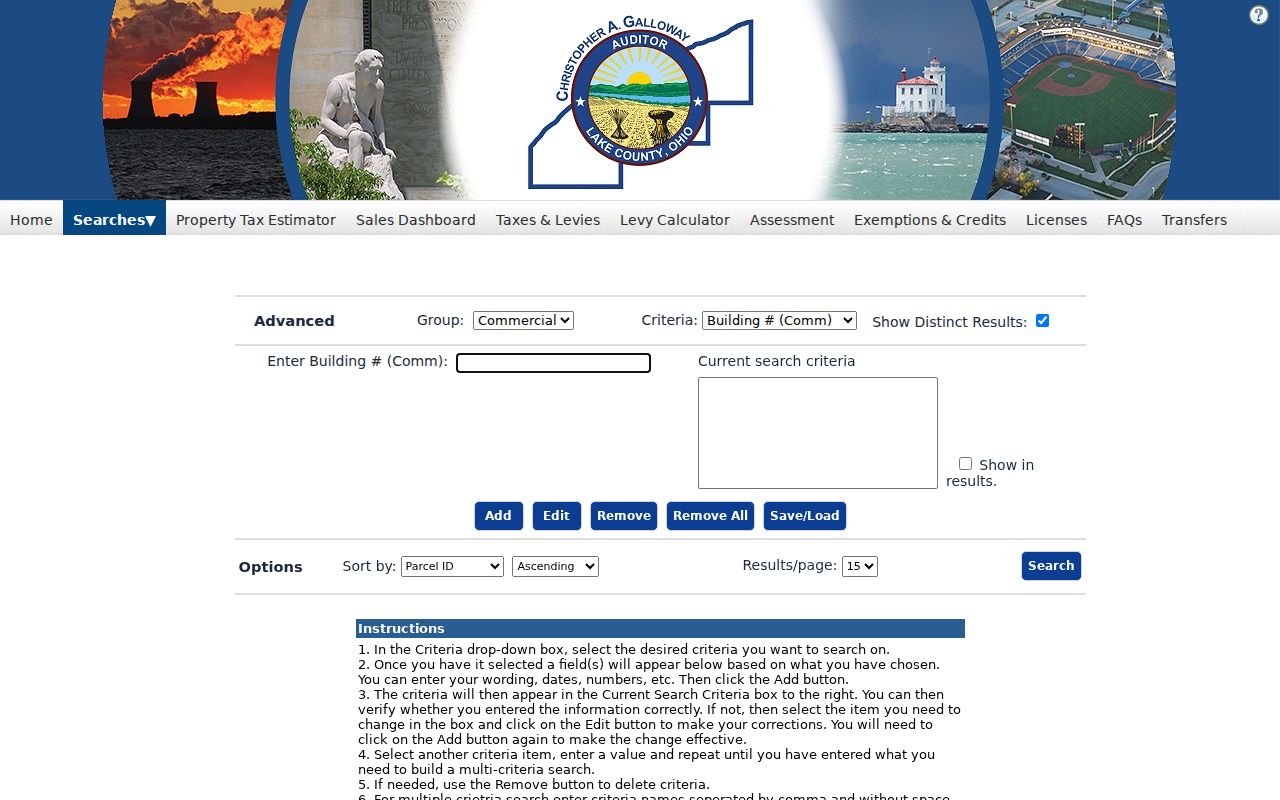
The controls shown there are useful for narrowing a street result, but the resulting owner field remains assessment evidence rather than a household claim.
Map Concord Township Street Parcels
LakeNavigator is the map step in a Concord Township by-address workflow. Its documented Search tool accepts a PIN, owner name, or address. Once the target parcel is selected, zoom out only far enough to see road alignment and nearby polygons. The viewer can show parcel geometry, imagery, tax-map links, historical aerial material, and more than 30 published layers. It is not the county’s ownership custodian and it is not a survey.
Use the parcel ID as the handoff. A formatted street address can change after a lot split, consolidation, or subdivision change. The parcel ID and recorded legal description are stronger keys when the map, Auditor card, and deed index need to be reconciled.
Lake County’s GIS department page describes the available viewer paths, layers, and data access.
A map layer can clarify which parcel fronts a road, but it cannot establish a legal boundary or identify who physically occupies the land.
Concord Township Address Record Coverage
Several Concord Township records are keyed to an address, a parcel, or a document reference. Their value lies in the handoff between them. None produces a complete street directory of every household. The table separates the useful output from the limit that should travel with it.
| Address record | Keeper | Useful street result | Limit |
|---|---|---|---|
| Assessment parcel record | Lake County Auditor | Parcel ID, situs, assessed owner, and displayed mailing data | Does not establish all occupants or household members. |
| Parcel map | LakeNavigator / County GIS | Parcel geometry, roads, adjoining polygons, and map layers | Does not decide title or a survey line. |
| Recorded instruments | Lake County Recorder | Dated deed, mortgage, plat, lien, release, or related filing | A recorded party is not automatically a current occupant. |
| Zoning or site-plan record | Concord Township / Lake County | Project or reviewed-plan context tied to an address | It records land-use activity, not residence. |
| Haines criss-cross listing | Morley Library | Dated address-to-listed-name directory entry | Holdings have gaps and directory inclusion varies. |
| Voter record | Ohio / Lake County Board of Elections | Limited electoral context after a precise person match | It is not a public browse-by-street tool. |
A situs address is the physical property location. A mailing address is where assessment correspondence goes. A legal description is the recorded description that identifies the land in a conveyance. Those fields should never be merged into a single claim about residence.
Follow Concord Township Street Deeds
The Lake County Recorder is the custodian for deeds, mortgages, plats, liens, releases, and related land records. Public AVA gives basic information, while Laredo Select is a registered advanced channel. The Recorder also maintains a Records Room. Start from the identified parcel and current acquisition instrument, then match the legal description before deciding that a grantor or grantee belongs in the same parcel history.
A grantor is the party conveying an interest. A grantee is the party receiving it. A plat is a recorded plan that lays out lots, streets, or subdivisions. These document roles help explain ownership changes along a Concord Township street, but they do not create a current resident list.
The Recorder’s research-options page explains the basic and registered search paths. When AVA does not resolve an older record, ask the Records Room or the Recorder about the live method for party roles, instrument references, dates, or book and page material. The office does not publish a reliable historical online cutoff.
Concord Township Street Permit Evidence
Permits add a different kind of dated evidence to a Concord Township street search. The township says zoning permits can be needed for decks, pools, fences, sheds, accessory structures, signs, changes of use, and construction. Lake County Building Inspection can handle a related building permit. A permit can show an application, approval path, project description, or named applicant. It does not prove title, completion, payment, or present residence.
The County Site Plans application is another address channel. It uses a Jurisdiction selector, House Number, and Street Name. Select the appropriate township and keep the plan reference with the address. Approved site plans are not Recorder instruments, so a plan belongs beside, not inside, the deed trail. For records with no searchable screen, Concord Township’s optional public-records request form can identify the specific permit, meeting record, or cemetery record sought under the Ohio Public Records Act.
Lake County Building Inspection’s monthly permit reports add a dated county channel for 2021 through 2026. Use a report to identify the month and type of documented development, then ask the appropriate office for the actual underlying file when it is needed. A monthly report is a lead to a project record, not a complete address history or a statement about who occupied a property.
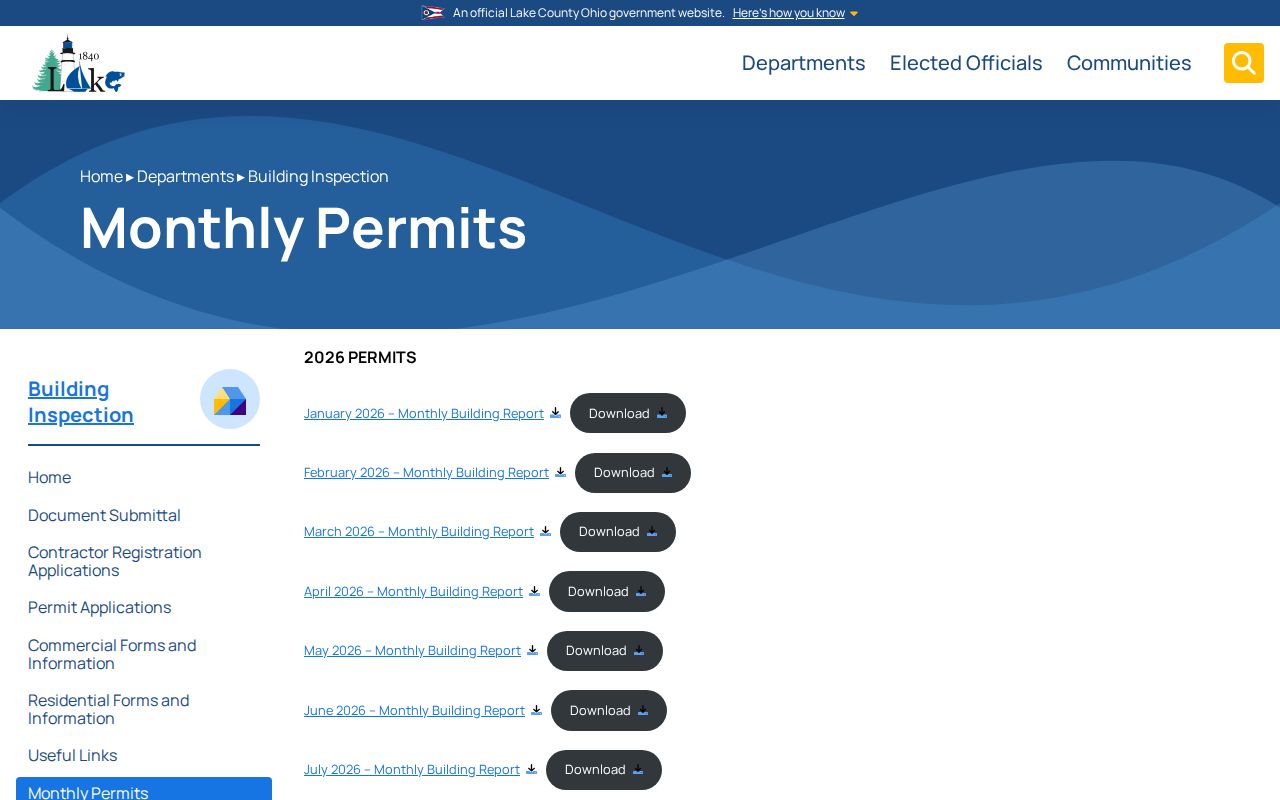
The official reports screen helps date a recorded development item. It should be read alongside the parcel and permit reference, never as a substitute for a deed or a household record.
A Concord Township zoning application can carry the property location, ZIP, parcel number, subdivision, applicant or owner details, project type, utility information, and township review fields. It also requires applicable plans and a survey map or scalable site plan. Those fields make a specific Concord Township permit useful for a dated address question, but an applicant may be an agent or contractor. Retain the application number, action date, and the source that supplied the record.
Note: Preserve the project date and source because a zoning or plan record describes a land-use event, not a person’s daily presence.
Concord Township Street Listings at Morley
Morley Library supplies the historical address layer for Concord Township. Its Haines & Co. Lake-Geauga criss-cross holdings include 1976, 1977, 1981 through 1987, 1989, and 1991 onward. A criss-cross directory reverses the usual name-first arrangement: start at the street address and find the listed name, then consult the alphabetic listing from the same volume for its own details and abbreviations.
Morley also holds a Painesville directory series that explicitly includes Concord Township from 2000 onward. The library’s stated gaps matter. A result from 1987 and one from 1989 leave 1988 unknown, and a listed name should be reported as a dated directory listing, not as proof that every person at an address was recorded.
The full volume holdings and local-history access are available from Morley Library’s city-directory inventory. For a deeper historical household trail, use the separate Concord Township city directory resource.
Concord Township Street Listing Milestone
Morley identifies 1923 as the first Painesville directory in its holdings with a street-address listing. That is a useful milestone for a street-focused search, but it is not a promise of township-wide Concord coverage for that year. Earlier Painesville and regional volumes can supply a name or place lead, while the explicitly Concord-inclusive ordinary directory series begins in 2000.
For an old Concord address, preserve the place wording in the volume. Concord was separated from Painesville Township in 1822 and joined Lake County when it separated from Geauga County in 1840. A historic description may therefore use Painesville, Geauga, or Lake context rather than a current postal form. Use the parcel description and atlas evidence to bridge those changes.
Concord Township Postal Limits by Street
Postal geography is not township geography. Lake County’s postal reference lists Concord Township under 44077, 44060, and 44024. An address can carry a Painesville, Mentor, or Chardon mailing association while the parcel remains in Concord Township. Verify delivery formatting with USPS ZIP Code Lookup, then use the Auditor record and LakeNavigator to confirm the parcel’s map location.
Use postal code as a narrowing field, not as a boundary verdict. Direction and suffix also have their own Auditor fields, so retain the road form that each custodian displays before deciding two records name different locations.
Limits on Concord Township Street Records
An address search cannot reveal every household member. County property files identify assessed owners, and mailing data can differ from the situs address. Utility and delivery customer lists are not public. Ohio motor-vehicle address data are confidential under ORC 4501.27 and the federal DPPA. Voter records also have statutory exclusions, including protected address records. Do not try to fill those gaps with guesses.
Ohio’s public-record rule is not a license to republish protected fields or pressure a person at an address. For a suspected misleading deed notice or suspicious instrument, verify the actual document with the Recorder rather than accusing a named party.